
Map a Ypsilanti Street by Address
The best address workflow follows the strength of each record. Start with the county’s parcel search to turn a typed address into its stable parcel number and legal description. That establishes the property, not a resident. Next, use the taxpayer name or a sales-history reference to locate a recorded instrument, then compare the address with lawful voter information and dated reverse directories. The last two sources can add a household clue, but neither should be treated as a current roster. Keep the street spelling, municipality selection, parcel number, and date with each result so later checks can be repeated.
- Search the address in the Washtenaw County Parcel Lookup. Enter the street number and street name without its suffix, then choose City Of Ypsilanti when that is the municipal jurisdiction.
- Save the parcel number, situs address, taxpayer names, taxpayer mailing address, legal description, and any sales-history reference. A taxpayer or mailing address is not proof of occupancy.
- Use the recorded party and Liber-Page clue in the Washtenaw Register of Deeds index. Search spelling variants because the county describes the index as a finding aid.
- For a lawful civic question, use the Michigan voter process as a confirmation layer. The public address tool is not a street-wide file, and protected voter details stay protected.
- Compare a dated street entry in the Heritage Room or another local collection. That can identify a listed household for that edition, then the deed and parcel records can test the address history.
Use the chain in that order when an address has a long history. It keeps ownership, mailing, registration, and historical listing evidence separate instead of turning a single result into a claim about a person.
Ypsilanti Street Directory Parcel Fields
The county form is the most concrete street-by-street starting point. It accepts a parcel number, a street name and number, an address range, or a taxpayer name. The street-name instruction is unusually important: use Main, not Main St. The city, village, or township selector includes both City Of Ypsilanti and Ypsilanti Township, so choose the jurisdiction before interpreting a result. Range searching may help orient a block, although the county did not publish the range result limit or pagination behavior.
| Parcel Lookup field | Input or selection rule | Why it matters by street |
|---|---|---|
| Parcel Number | 12 characters: XX-XX-XX-XXX-XXX, including spaces | Stable link among parcel reports, maps, and deed references |
| Street Name | Street name only, such as Main | Primary street-search entry point |
| Street Number | Use with Street Name | Targets one property address |
| Range From / Range To | Text fields | Useful for initial block-scale orientation |
| City, Village, or Township | Select City Of Ypsilanti or the correct jurisdiction | Separates city records from township results |
| Taxpayer Name | Last name first | Lets a parcel clue be checked by party name |
See the county’s parcel and street search before entering an address. The form shows why an address search begins with a normalized street name, not an assumed resident name.
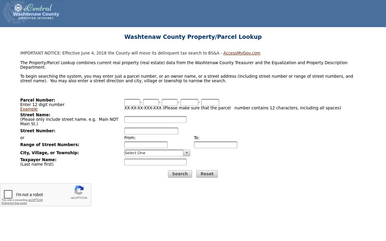
The visible form supports number, name, range, municipality, and taxpayer approaches. Those choices help repair an address that was entered with a suffix, direction, or jurisdiction that the first search did not recognize.
Former Names on Ypsilanti Streets
Older Ypsilanti street references need their own search pass. Local historical material describes three Mill Streets on an 1859 map, later associated with Forest, Maple, and Park. It also records Arcadia becoming Arcade and Ainsworth Place becoming Middle Drive. Old Michigan Street was discontinued on June 5, 1916, to reduce confusion with Michigan Avenue. These are documented variants, not a formula for converting every old address.
When a historical listing will not resolve, try the original spelling, suffix, direction, nearby cross street, plat, and legal description. Compare a dated directory or map with the parcel record before deciding that a property vanished. Ypsilanti’s historic street changes explain a failed exact-match search without inviting a guess about the modern address.
Note: Preserve the name exactly as printed in each older source, then add a separate modern-search note only when the map or plat supports it.
Ypsilanti Street Records by Source
Address-keyed sources overlap, but they do not say the same thing. The parcel system supplies the present administrative view. The Register of Deeds tracks recorded parties and instruments. A city permit may date a project rather than a household. MapWashtenaw supplies location context, while directories and maps supply dated evidence. Keep the field name supplied by the custodian, especially taxpayer, mailing address, property address, or recorded party.
| Address record | Ypsilanti-area keeper | Street evidence | Access channel |
|---|---|---|---|
| Parcel lookup and reports | Washtenaw Treasurer and Equalization/Property Description offices | Parcel, situs, taxpayer, mailing, legal, assessment, and sales fields | Public county search and report templates |
| Recorded instruments | Washtenaw County Register of Deeds | Parties, document type, date, and Liber-Page reference | Online index, counter, or mail copy request |
| Parcel map | MapWashtenaw | Parcel geometry, aerials, topography, and nearby context | Public WebGL2 viewer, reference only |
| Permits and inspections | City of Ypsilanti | Project address, parcel, permit, and inspection clues | Permit Center routing or city records request |
| Dated directories and maps | Ypsilanti District Library and local archives | Listed household, street entry, building or neighborhood context | Library, archive, microfilm, and collection request |
The parcel number is the durable join between these systems. A street name can change, a parcel can be split or combined, and a mailing address can belong elsewhere. Use the deed or survey for a legal description, not a map outline.
MapWashtenaw Along a Ypsilanti Street
MapWashtenaw adds the visual layer to a Ypsilanti address search. The county describes current property data, aerial photography, natural features, topography, labels, queries, and other GIS functions. Use it to orient a street, inspect adjacent parcel shapes, or compare a boundary with an aerial view. Its live field inventory was not available during research because the viewer requires WebGL2, so do not assume a particular filter or layer exists.
The county warns that the viewer is reference-only and may contain spatial, attribute, currency, or representation errors. A colored parcel is useful for orientation, but a deed, survey, plat, or assessor legal description is the stronger source when a boundary matters.
Follow Ypsilanti Deeds by Reference
Parcel sales history can supply a Liber-Page, sale date, instrument, and sale price. Use that reference to move into the Register of Deeds index, where recorded parties and instrument details form the ownership trail. Start with the current or most recent recorded transfer, identify the prior grantor, and repeat backward with spelling variants, initials, and former names when needed. The public deed index is a guide to the instrument, not the instrument itself.
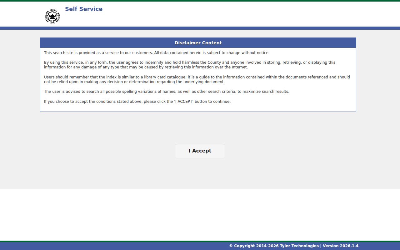
Open the Washtenaw Register of Deeds public index for the recorded-search entry point. Its full search form was blocked by a human-verification gate during research, so the exact online filters and historical cutoff are not stated here.
When an index result requires the underlying document, the county’s mail request form accepts names on the document, document type, page count, Liber, Page, and certification count. It lists copies at $1 per page, certification at $5 per document, and a $12 per-name search fee; no processing time is published.
Read a Ypsilanti Parcel Card Carefully
A parcel report separates facts that are often blurred in casual street searches. The Parcel Summary includes parcel number, municipality, property address, school district, taxpayer names, taxpayer mailing address, assessment year, values, and principal-residence exemption percentage. The Legal Description report adds the legal description. Sales History adds the property address, municipality, Liber-Page, sale date, instrument, and sale price. Each field describes a particular administrative or recorded relationship.
- Parcel
- A county identifier for a property record. It is the most useful stable bridge between a typed address, the report, and map context.
- Situs address
- The physical property address recorded for the parcel. It differs from the place where a taxpayer receives mail.
- Plat
- A recorded map that divides land into lots and streets. It can help reconcile an old address or a changed parcel.
- Criss-cross directory
- A reverse directory arranged by street and number rather than by personal name, useful as a dated household listing.
View the county parcel report templates before interpreting a name in a street-search result.
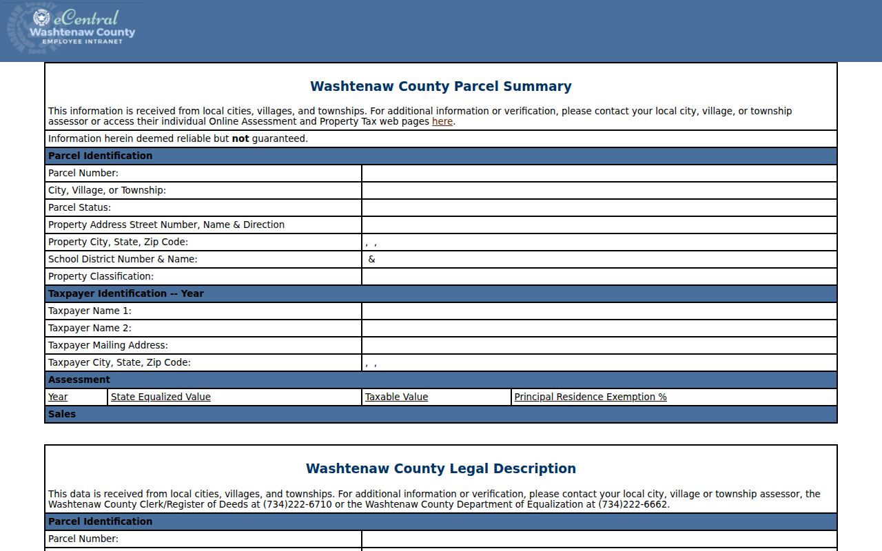
The separate reports make it possible to note what the county actually labels as taxpayer, property address, or sale reference. That distinction prevents a street-level result from being overstated as a resident finding.
City or Township on Ypsilanti Streets
Ypsilanti mailing language and local jurisdiction do not always match. The county selector distinguishes City Of Ypsilanti from Ypsilanti Township. The two ZIP labels, 48197 and 48198, reach beyond the city boundary, so a postal label cannot settle the municipal question. Record the street address, municipality choice, parcel number, and legal description together before making a city-records or county-records request.
This local distinction matters: a ZIP tells a delivery story, while the parcel selector tells the municipality used for property research. If an address result lands in the township, city-held permit or clerk material may not be the right next stop.
Ypsilanti Permit Clues by Address
A permit or inspection can date work at an address without identifying every person tied to the property. The City of Ypsilanti’s Permit Center routes requests by department and maintains forms and local permit information. Start a request with the project address, parcel number, permit type, and date range. If an online record is incomplete, the city clerk and municipal records route provide a more direct way to request a specific city-held record.
For the city’s property route, use the BS&A Property Search Portal page. It directs visitors to assessing, current tax, building and inspection, and special-assessment searches. The research did not capture its complete live field set or a historical coverage range.
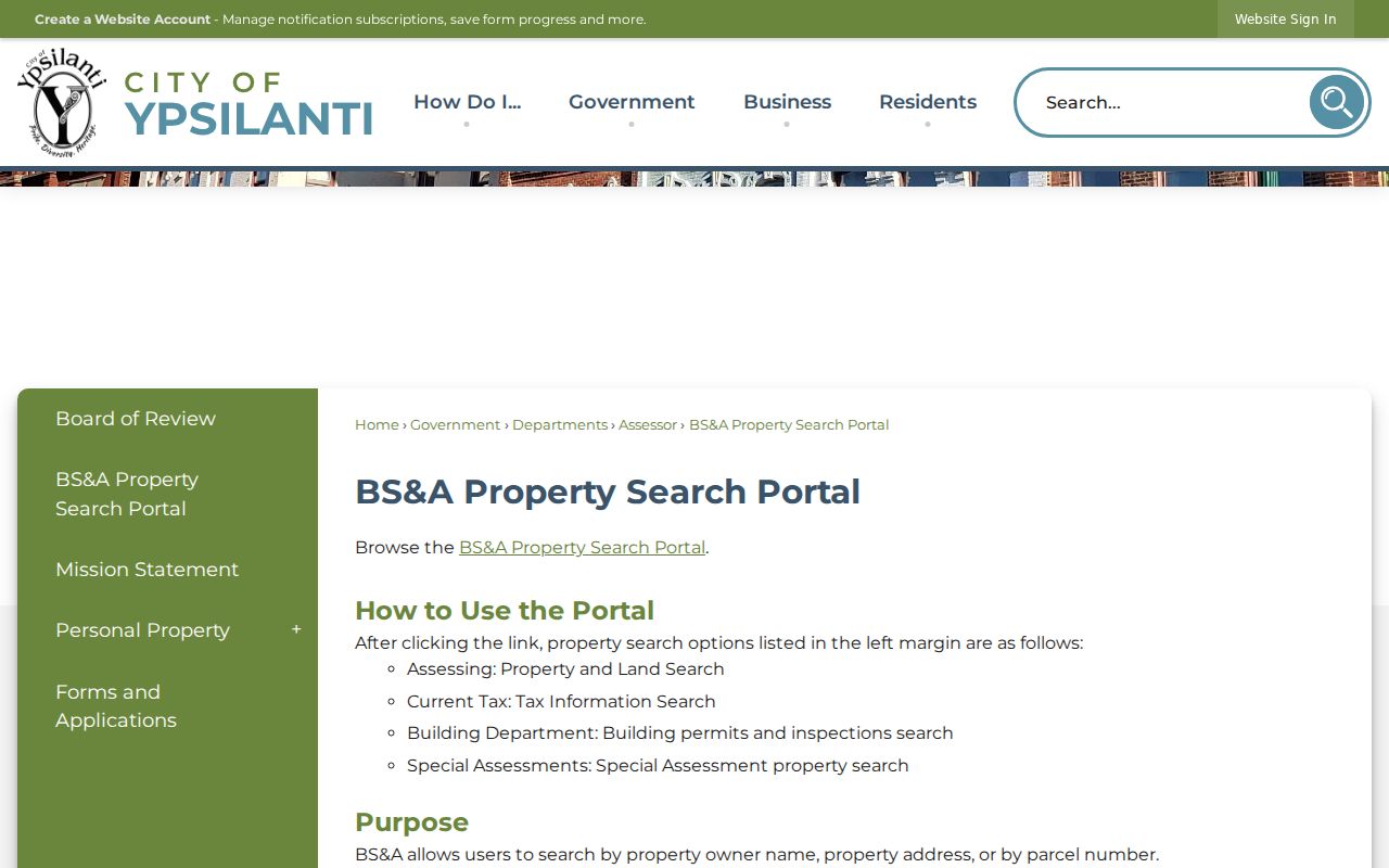
A permit clue belongs beside the parcel and deed trail, not in place of it. It can explain a dated change at the address, while the recorded instrument and legal description answer different questions.
Note: Request the smallest useful record set and retain the address, parcel, project type, and date range that explain why the city record was sought.
Ypsilanti Street Listings in Time
A printed street entry is historical evidence, not a current occupancy statement. The Ypsilanti District Library Heritage Room holds directories dating to 1913, and the city survey identifies directories from 1874 through 1977. Other cataloged runs reach 2001 with year-by-year gaps. Read the volume date, street spelling, number, abbreviation, and household form before connecting it to a parcel.
For an older household trail, use the Ypsilanti city directories as the collection route, then return to the address chain for modern parcel and deed verification. A missing entry may reflect a publisher change, an abbreviated name, a prior street number, or a source gap. It does not establish that a home was empty or that someone left the city.
Limits of a Ypsilanti Street Directory
No public street search proves a complete household at a present address. Parcel records can show a taxpayer and mailing address that belong to an estate, trust, business, representative, or other non-occupant. A dated directory may list only one household member and may use an old street form. Michigan voter records have protected fields, and the public address route is not a downloadable street roster. Utility customer information and motor-vehicle personal information are not a substitute source.
Lawful use. Use Ypsilanti address records for family history, property history, civic questions, record correction, or another lawful personal purpose. Do not use them to stalk, harass, threaten, or expose any person; Michigan law protects against repeated unwanted conduct.
When evidence conflicts, identify the disagreement rather than merging it. A deed supports a recorded conveyance, a parcel card supports a current administrative snapshot, a directory supports what a publisher printed, and a map supports physical context.